One pixel changes meaning
GSD controls how much physical ground each pixel represents, changing visible canopy detail.
AIT Master's thesis · Geospatial AI
A six-model instance-segmentation benchmark for detecting and measuring oil-palm canopies across eight UAV image resolutions.
The operational problem
A detector trained at one drone height can fail over the same plantation at another. Ground Sample Distance is the hidden variable connecting flight planning to model reliability.
GSD controls how much physical ground each pixel represents, changing visible canopy detail.
A model trained at 0.03m GSD performed 40% worse at 0.20m on the same plantation.
Deployment requires choosing altitude, model, speed, and canopy precision as one system.
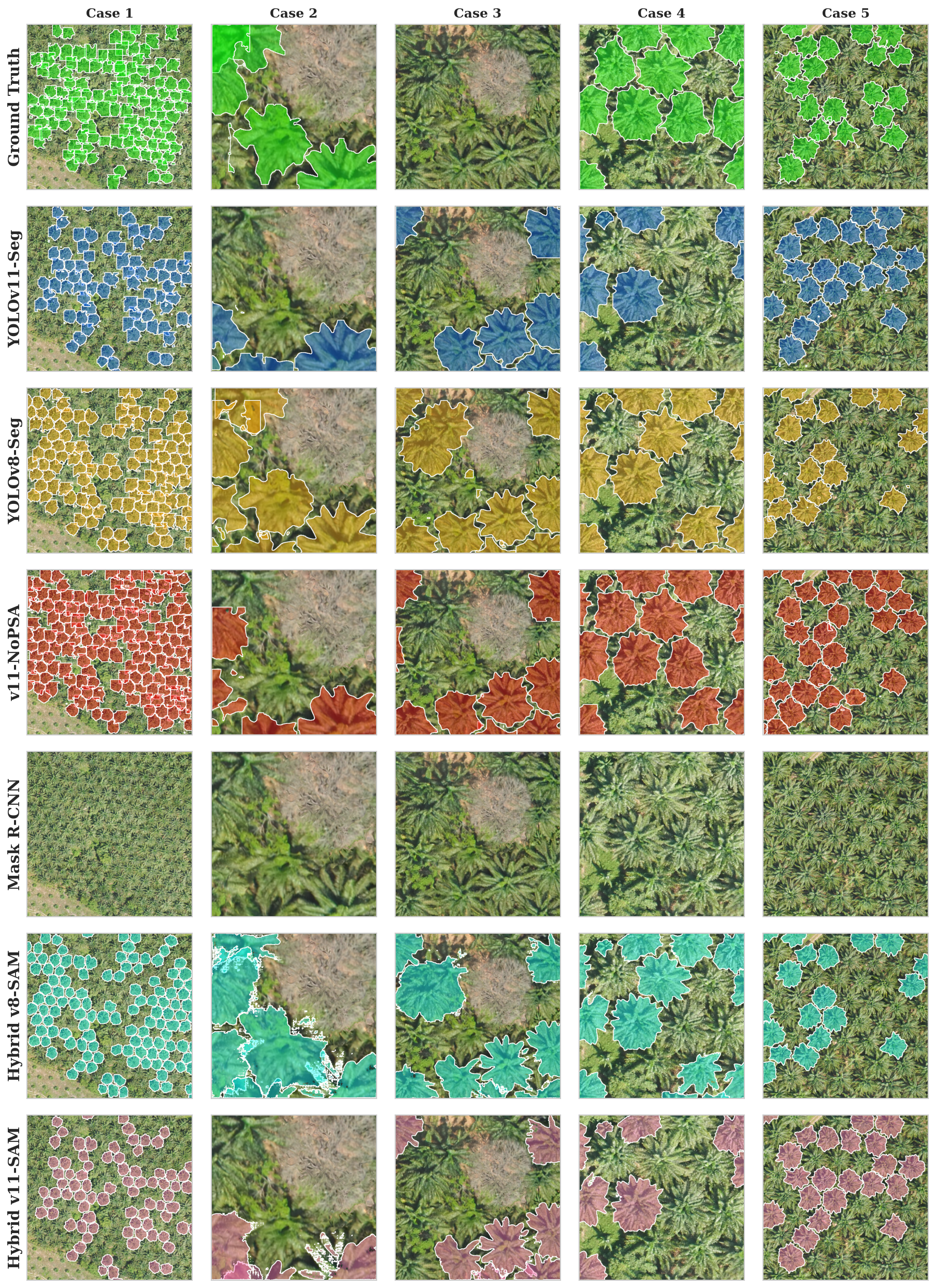
Six models enter
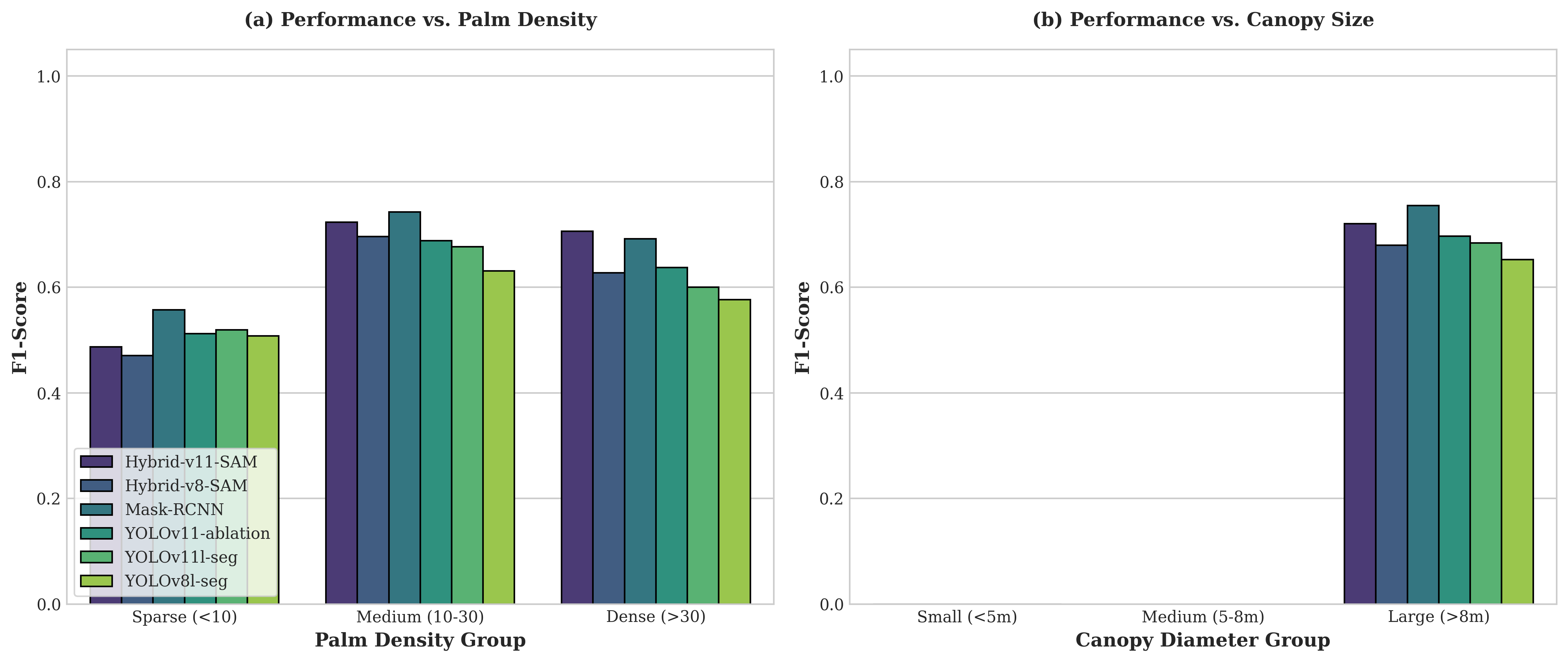
YOLOv11 standalone delivered the best mean IoU while running roughly ten times faster than the YOLO+SAM hybrid.
Agent-orchestrated pipeline
The best trained model becomes a Teacher Agent, scaling annotation before the full benchmark and physical measurement stages.
500 manually annotated UAV images establish trusted labels.
YOLOv11 propagates annotations across tiled GSD variants.
Six architectures train and evaluate under the same protocol.
Polygon masks become canopy area and equivalent diameter.
Reproduce the work
The repository contains model code, evaluation results, notebooks, and the full multi-GSD pipeline.
git clone https://github.com/Sai21112000/oil-palm-instance-segmentation.git
cd oil-palm-instance-segmentation
pip install -r requirements.txt

# Explore notebooks, models, src, and results
Research made operational
Explore the source, results, and complete six-part technical story.